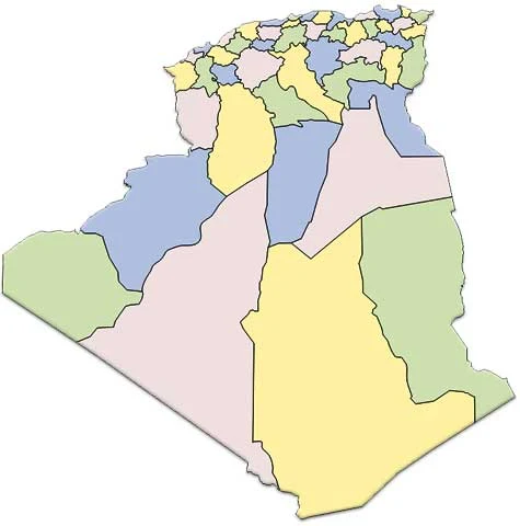
Algeria Map in Africa
Regional Maps: Map of Africa, World Map
Map Location
Black and white Map
Map blank white emboss
Map blank color emboss
Important city of Algeria: Adrar, Ain Temouchent, Alger (Algiers), Annaba (Bone), Batna, Bechar, Bejaia, Bejaia (Bougie), Biskra, Blida, Bou Saada, Constantine, Dellys, Djelfa, El Harrach, El Oued, Laghouat, Mostaganem, M'sila, Oran, Ouargla, Setif, Skikda (Philippeville), Taghit, Tebessa, Tindouf, Tizi Ouzou and Tlemcen.
Things to know
| Continent | Africa |
| Region | North Africa |
| Coordinates | 28°00′N 3°00′E |
| Area | Ranked 10th |
| • Total | 2,381,741 km2 (919,595 sq mi) |
| • Land | 100% |
| • Water | 0% |
| Coastline | 1,622 km (1,008 mi) |
| Borders | Land boundaries: 6,343 km |
| Morocco 1,559 km, | |
| Mali 1,376 km, | |
| Libya 982 km, | |
| Tunisia 965 km, | |
| Niger 956 km, | |
| Mauritania 463 km, | |
| Western Sahara 42 km | |
| Maritime claims | 32–52 nm |
| Highest point | Mount Tahat, 2,908 m |
| Lowest point | Chott Melrhir, −40 m |
| Longest river | Chelif River, 230 km |
| Climate | arid to semiarid |
| Terrain | mostly high plateau and desert, mountains, narrow coastal plain |
| Natural Resources | petroleum, natural gas, iron ore, phosphates, uranium, lead, zinc |
| Natural Hazards | earthquakes, mudslides, floods, droughts |
| Environmental Issues | soil erosion, desertification, pollution |


