Angola Map of Africa

Angola Bordering Countries: Democratic Republic of the Congo, Republic of the Congo, Namibia, Zambia
Regional Maps: Map of Africa, World Map
Map Location

Black and white Map of Angola

Outline Map blank white emboss

Map blank color emboss

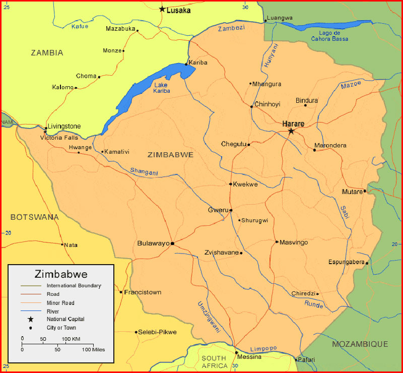
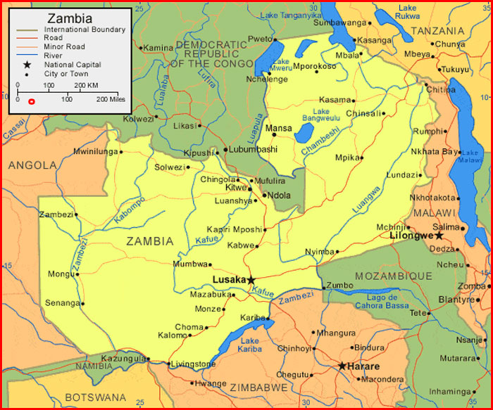
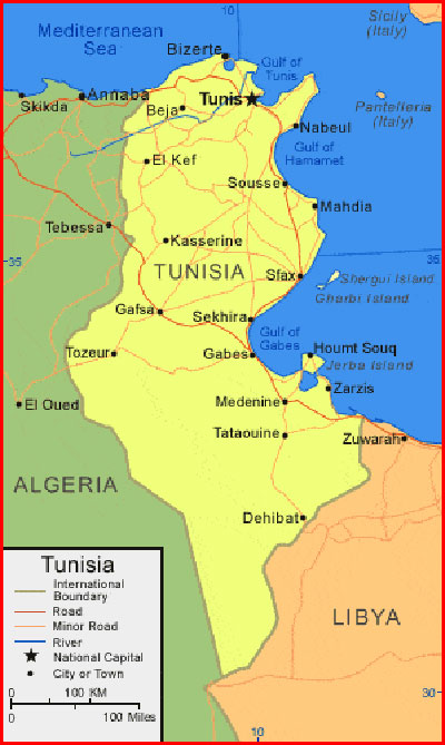
Important city of Angola: Andulo, Balombo, Benguela, Benguela, Caconda, Caiundo, Camacupa, Cambulo, Canzar, Cuango, Cubal, Cuilo, Dondo, Gabela, Huambo, Kuito, Lobito, Lovua, Luanda, Lubango, Lucapa, Luena, M?banza Congo, Malanje, Mavinga, Menongue, Muconda, Mussende, Namibe, N’dalatando, Negage, N’zeto, Quibala, Quinzau, Saurimo, Songo, Soyo, Tombua, Uige and Xangongo Ondjiva.
Thing to Know
|
Continent
|
Africa
|
|
Region
|
Southern Africa
|
|
Coordinates
|
12°30′S 18°30′E
|
|
Area
|
Ranked 22nd
|
|
• Total
|
1,246,700 km2(481,400 sq mi)
|
|
Coastline
|
1,600 km (990 mi)
|
|
Borders
|
Land boundaries: 5,369 km
|
|
DROC 2,646 km
|
|
|
Republic of Congo 231 km
|
|
|
Namibia 1,427 km
|
|
|
Zambia 1,065 km
|
|
|
Highest point
|
Mount Moco, 2,620 m
|
|
Lowest point
|
Atlantic Ocean, sea level
|
|
Longest river
|
Congo River, 4,344 m
|
|
Terrain
|
narrow coastal plains, hills and mountains, high plains
|
|
Natural Resources
|
petroleum, diamonds, ironore, phosphates, copper, feldspar, gold, bauxite, uranium
|
|
Natural Hazards
|
occasional heavy rainfall with accompanying floods
|
|
Environmental Issues
|
deforestation, overgrazing of meadows, air pollution, waste disposal
|
Nama asli saya Supriyadi dan populer Supriyadi Pro. Saya seorang Expert wordpress developer freelancer, content writer, editor. Memiliki minat besar pada dunia teknologi, sains, seni budaya, social media, dan blogging. Saya kelahiran suku Jawa, di Wonogiri, Jawa Tengah yang ahli bahasa Jawa dan seni gamelan. Silahkan hubungi saya lewat laman yang telah disediakan atau kunjungi website profil saya di https://supriyadipro.com